
The cold front has pushed through the Panhandle,
and is working its way into the peninsula. Impacts should be expected in the
western Panhandle from freezing rain this afternoon and evening. Conditions will start to degrade this
afternoon in the western Panhandle, especially north of I-10. Tonight, the
potential for freezing rain will spread east across the Panhandle, while some
sleet and maybe a few flakes of snow mix in back to the west. By tomorrow
morning, the potential for at least some minimal icing will spread east to
Tallahassee.
Though chances for rain will continue
into the peninsula Wednesday afternoon and evening, there isn’t potential for
any freezing – just rain. While much of the Panhandle will struggle to get
above freezing tomorrow, highs look to be back into the 40s or low 50s by
Thursday already. In the peninsula, Thursday highs will range from the 50s north
to the mid 70s near Miami. Winds should
be relatively light ahead of the front in the coming days, while it slogs down
the peninsula. Winds will range from about 10 mph up to the middle teens behind
the front – primarily in the Panhandle today, but stretching into parts of the
northern and central peninsula tomorrow.
 |
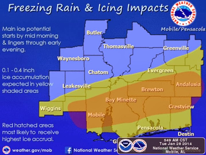
Expected impacts in the eastern Panhandle, with more severe impacts to the west, trailing off towards the east.
|
By: Sean Luchs, Meteorologist - Florida Forest Service, FDACS


No comments:
Post a Comment