
 Rina continues to weaken.
However, it is expected to slowly move northeast away from the Yucatan today.
The main threat from Rina is rainfall.
Much of the rainfall has ended across the Yucatan, along with the threat for widespread flooding problems.
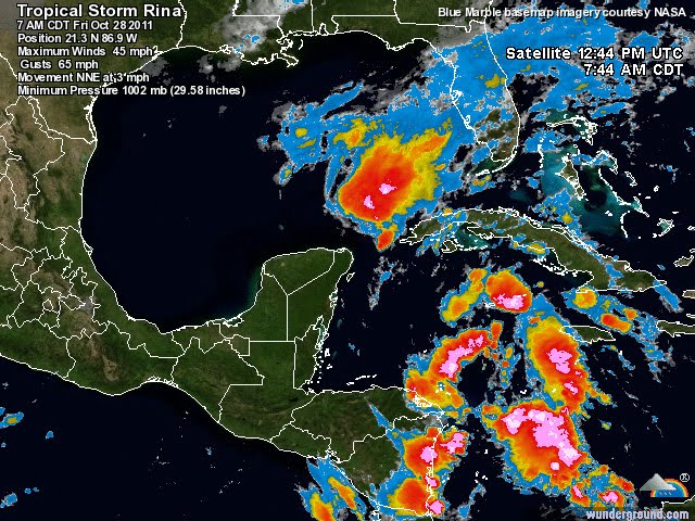
The current satellite picture continues to show Rina weakening.
The center of circulation is now to the south of the strongest convection thanks to strong upper-level wind shear.
The convection will continue to be ripped away from the low-level center of circulation today as shear is not expected to change.
This will leave nothing more than a low-level swirl of clouds by the weekend, when eventually Rina will turn around and begin to drift south and back out over the Caribbean as a remnant low.
We have also been monitoring a tropical wave over the southern Caribbean. Although the wave is producing widespread showers and thunderstorms, development into a tropical system appears unlikely for the next several days.
A third system, a low pressure center to the west of the Cape Verde Islands, is producing an area of showers and thunderstorms; however, due to wind shear aloft, it is currently not expected to develop into a tropical cyclone over the next couple of days.
By AccuWeather.com Senior Meteorologist Matt Rinde and Meteorologist Eric Leister.


No comments:
Post a Comment