
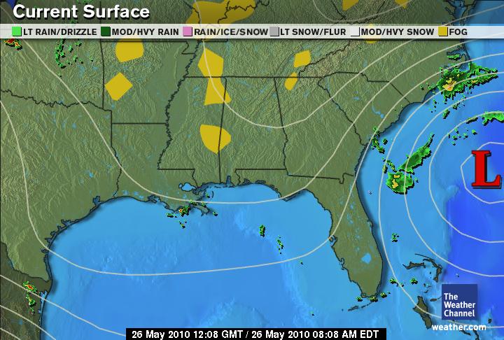
 A non-tropical low pressure system backs its way toward the coast of South Carolina through this afternoon.
Occasional heavy showers, winds of 15 to 25 mph, minor coastal flooding and minor beach erosion are possible from the Outer Banks of North Carolina through northeast Florida.
The low should begin to move away from the coast tonight with very little impact expected on the Southeast coast Thursday.
Isolated to scattered thunderstorms are possible over most of the region particularly during the afternoon and evening hours.
The most concentrated activity should be over eastern Oklahoma, southern Arkansas, northeast Texas, Louisiana, southern Mississippi and southern Florida.
About the only dry areas forecast across the region today are interior sections of North Carolina and South Carolina, most of Georgia away from the coast and northern mountains, northern Florida away from the coasts and southeast and southern Texas.
Temperatures should be close to average for late May with high temperatures mostly in the 80s to lower 90s.
Forecast by Weather.com


No comments:
Post a Comment